加
載
中
BE POST-TENSIONING SYSTEM
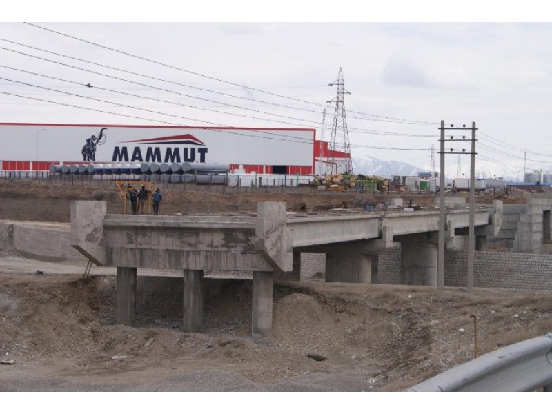
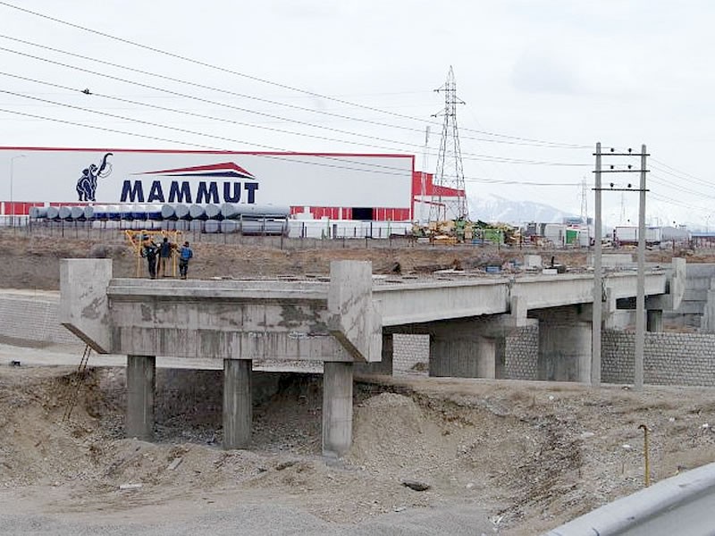
Project Description:Kordan Bridge Beams
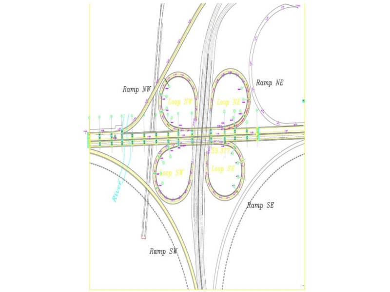
Project Description: Caspian Free zone org
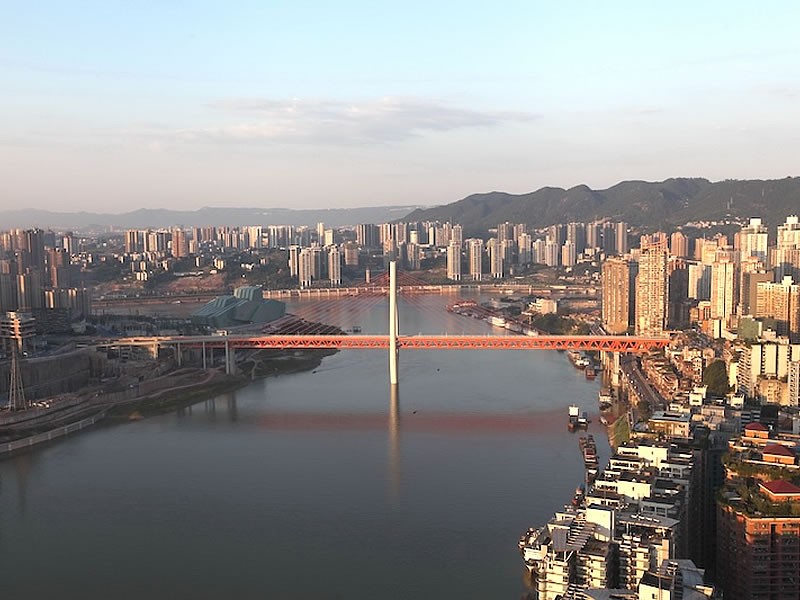
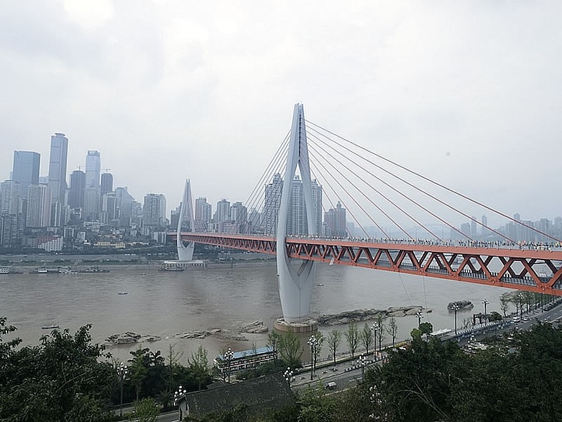
The Chongqing Qiansimen Jialing River Bridge is located in the heart of Chongqing. It begins at Shaanxi Road in Yuzhong District, connecting to the northern abutment of the Dongshuimen Yangtze River Bridge. The bridge passes beneath the Yuzhong Peninsula via a tunnel and exits near the famous Hongyadong scenic area. It then spans the Jialing River and ends at Nandajie in Jiangbeicheng.
The total length of the project is approximately 1.60 kilometers, comprising the main bridge and approach structures (collectively referred to as the Qiansimen Jialing River Bridge proper), the Yuzhong connecting tunnel, and a system of ramps linking to the surrounding urban road network on both riverbanks.
The main bridge is a single-tower, single-plane cable-stayed steel truss structure, with span arrangements of 88 meters, 312 meters, 240 meters, and 80 meters. The main bridge section totals 720 meters in length, with a main span of 312 meters. The Yuzhong connecting tunnel is approximately 700 meters long and features a four-lane, two-way design.
The Dongshuimen Yangtze River Bridge is a key transportation facility spanning the Yangtze River in Chongqing, China. It is a double-deck cable-stayed bridge integrating both road and rail functions, connecting Yuzhong District and Nan’an District. As the first bridge crossing the Yangtze River from the Chaotianmen area of the Yuzhong Peninsula, it plays a central role in the city’s core transport network. Together with the Qiansimen Jialing River Bridge, it forms the "Two Rivers Bridge" system, serving as a critical transportation hub in Chongqing’s central urban area.
The bridge adopts a twin-tower, single-plane cable-stayed design with a total length of 1,124.947 meters and a deck width of 24 meters. Its main span reaches 445 meters. The structure features a two-level layout: the upper deck accommodates a four-lane urban secondary road, while the lower deck carries the dual-track Chongqing Rail Transit Line 6.
The bridge’s towers are shaped with a smooth, streamlined “watch hand” (tissot-style) design, blending structural function with urban aesthetic appeal. The south tower stands at 172.61 meters and the north tower at 162.49 meters, making them prominent landmarks in the region.