加
載
中
BE POST-TENSIONING SYSTEM
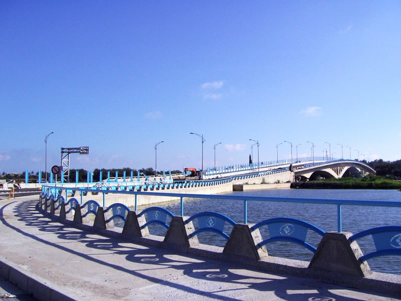
The Anping Port Cross-Harbor Bridge is a critical infrastructure project initiated by the Tainan City Government in response to the national policy of separating commercial and fishing port functions. With the opening of the old fishing port channel, areas such as the Sankunshen Wharf District and Yuguang Village in Tainan City would become geographically isolated. To ensure proper connectivity and maintain accessibility for both residents and port operations, the Kaohsiung Port Authority proposed the construction of this cross-harbor bridge.
The bridge, known as the Yuguang Bridge, spans the secondary navigation channel of Anping Port and the boundary between the port and the city. It measures 320 meters in total length and is designed as a five-span, four-pier reinforced concrete arch bridge. Construction methods include shored formwork for the side spans and a cantilever method for the central span. The approach roads extend approximately 266 meters in total, and the full bridge width is 24.5 meters. Dedicated lanes are planned to serve both the Anping Port area and the urban districts of Tainan.
BE POST-TENSIONING SYSTEM
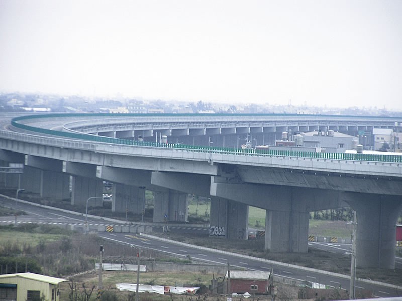
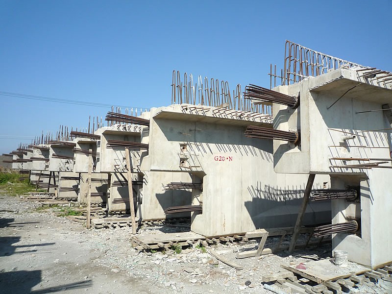
The WH33-1 section of the West Coast Expressway utilizes the BE post-tensioning system, which is designed and manufactured by our company. This project covers Sections WH33-1 to WH33-4, extending from Tongwan in Tongxiao Township to Chushui in Yuanli Township, Miaoli County, from kilometer mark 123K+800 to 130K+905. The total length is approximately 7.9 kilometers, consisting of a 7.1 km mainline and a 0.8 km connector road. Major works include approximately 6.9 km of viaducts, 1 km of embankment road, one interchange, and two on/off ramps (with an additional ramp reserved).
The bridge types employed include span-by-span erection, balanced cantilever construction, pre-stressed concrete I-girders (PCI), and hollow slab beams. Box girder cross-sections are rounded for improved aerodynamics and aesthetics. Typical spans range from 40 to 60 meters, while the crossings over Nanshi Creek and Yuangang Fishing Harbor are constructed using the balanced cantilever method, with a maximum span of 150 meters.
Reference: CECI Engineering Consultants, Inc., Taiwan
BE POST-TENSIONING SYSTEM
The Linbian Township Railway Elevation Project, also known as the Linbian River Bridge Improvement Project, is part of the Taiwan Railways Administration’s (TRA) railway elevation program.The project begins south of Zhen’an Station and extends to the area north of Jiadong Station, with a total length of approximately 4.6 kilometers.
Construction commenced in 2008, and on January 10, 2012, the railway section was switched from ground level to the elevated track, along with the opening of the new elevated station. The entire project was completed in June 2012.
The design included provisions for future double-tracking and railway electrification. Electrification was later implemented under the South-Link Line Electrification Project.
BE POST-TENSIONING SYSTEM
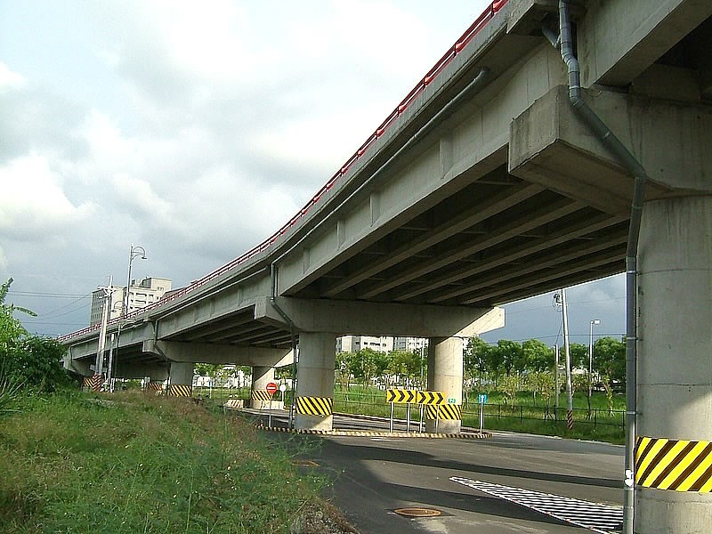
The Ronglin Overpass serves as a critical transportation corridor linking National Freeway No.1 Dalin Interchange, Dalin Tzu Chi Hospital, and the mountainous Meishan Township. Spanning the Taiwan Railways Western Trunk Line, the overpass plays a vital role in regional connectivity, emergency medical access, tourism, and daily commuter travel.
Due to the aging structure and its inability to meet current traffic and safety standards, the overpass is scheduled for reconstruction. The project aims to enhance seismic resilience, improve traffic safety, and strengthen the regional road network, while alleviating traffic bottlenecks at the railway intersection below.
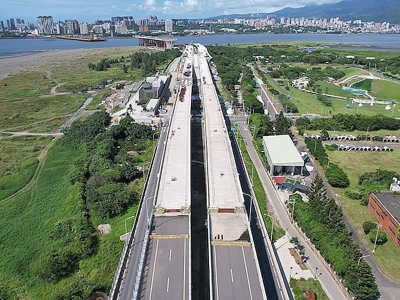
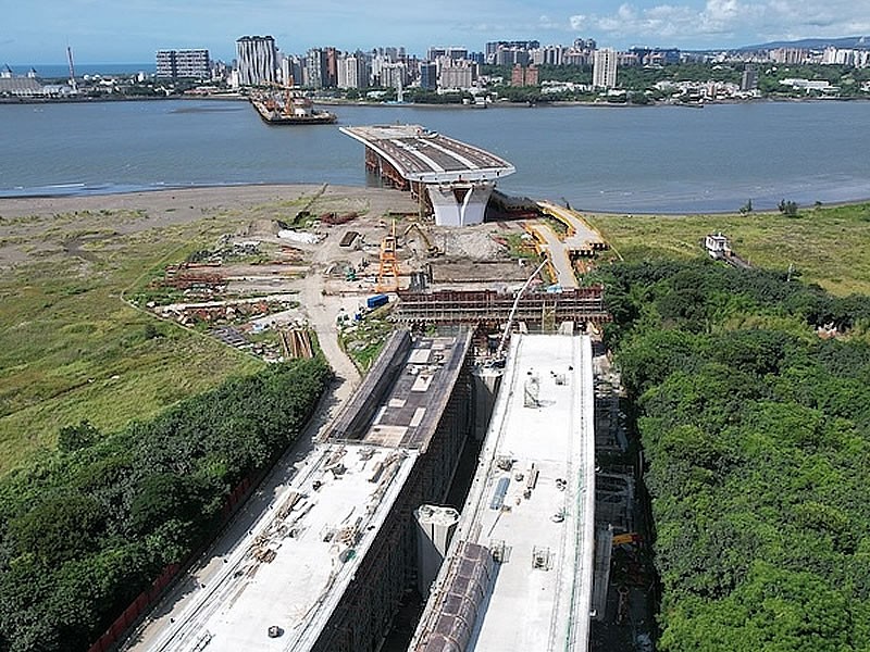
BE POST-TENSIONING SYSTEM
This project is located at the estuary of the Tamsui River. The planned route begins at Provincial Highway 61A (Km 2+146), follows the Port Avenue and the northern edge of the wetland, crosses the Tamsui River, and continues along Shalun Road to its endpoint at Section 1 of Shalun Road (Km 8+165), with a total length of approximately 6,019 meters.
The bridge deck will be 44 to 55 meters wide, incorporating four-lane dual carriageways, scooter lanes, sidewalks, and dedicated bicycle paths. It will also reserve space for future public transportation systems (e.g., Bali Light Rail), aiming to connect both sides of the Tamsui River and enhance the northern coastal transportation network in the Taipei metropolitan area.
In recent years, rapid development in Tamsui, Bali, and the North Coast—along with the completion of popular destinations such as Fisherman’s Wharf and the Shihsanhang Museum of Archaeology, the expansion of the Danhai New Town, and the operation of Taipei Port—has significantly increased traffic demand in the region.